Groundwater recharge modelling using SWAT analysis for groundwater reserve quantification of Ka watershed catchment area part of Sokoto-Rima Basin, North West Nigeria
Keywords:
Soil and Water Assessment Tool (SWAT), Groundwater Recharge, Water Budget, Hydrological Response Unit, Ka-River WatershedAbstract
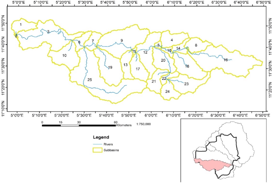
Recharge plays a major role in water resources management. However, measuring its spatiotemporal dispersion at the catchment region is an extremely difficult undertaking. This study used the Soil and Water Assessment Tool (SWAT) model and the Geography Information System (GIS) technique to estimate the recharge, spatial distribution, and potential recharge zones of groundwater at different scales in the Ka watershed catchment area. With the use of soil, land use, climate, and discharge data, as well as a digital elevation model, the SWAT model was established using data sets that span from (1996 – 2017), calibrated (2002 – 2017), and validated (2002–2017). The seven influencing groundwater recharge parameters that were integrated: rainfall, evapotranspiration, land cover/use, drainage, soil, hydraulic conductivity data, and runoff were utilized in mapping the recharge zones. The calibration and validation results are in good agreement with the field measured data, during the simulation exercise. Water balance analysis revealed groundwater recharge rate that ranges from 196.64 to 339.80 mm/annum with mean value of 269.08 as sole input into groundwater system which accounts for 28% of the input within this basin, while the basin receives mean precipitation of 972.83 mm/annum. The groundwater reserve of Ka watershed is estimated at 21,035,746.20 m3. This available groundwater potential is sufficient for both irrigational use and domestic usage based on the fact that the area is sparsely populated and entirely depend on agricultural produce for survival.
Published
How to Cite
Issue
Section
Copyright (c) 2025 Ahmad M. Shuaibu, Kizito O. Musa, Ijioma M. Okiyi

This work is licensed under a Creative Commons Attribution 4.0 International License.